Campus GIS Outreach
GAINS lab is the campus “one-stop” for geospatial technology and services. It manages GPS and survey equipment inventory for all academic departments and the New Mexico Forest and Watershed Restoration Institute.
The GAINS lab hosted GIS workshops during faculty development week. This resulted in broadened faculty awareness and interest in geospatial sciences, directly resulting in increased enrollment in GIS courses.
The lab also provided guest lecturers for professors desiring to promote the awareness of geospatial capabilities in their courses. Further contributed to increased enrollment in GIS courses. Also helped recruit students from social sciences and other disciplines outside the Natural Resources Management programs.
Lab personnel serve as co-Principal Investigators on various grant funded research projects, including the National Science Foundation funded study of the “Timing of Intercontinental Deformation across the Eastern Mono Basin, California and Nevada.”
Lab director participates in the NSF funded Integrated Geospatial Education and Technology Training (iGETT) project, which seeks to enhance the remote sensing education programs at community colleges and small universities.
Community Educational Outreach
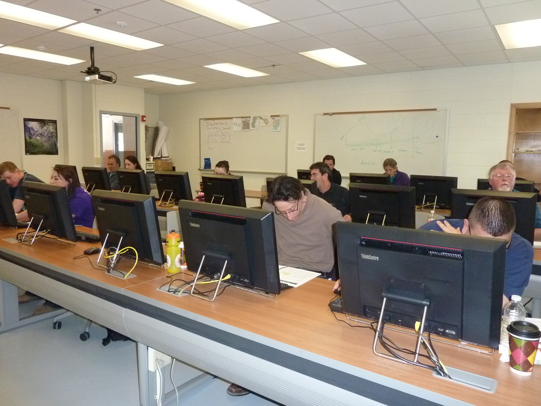
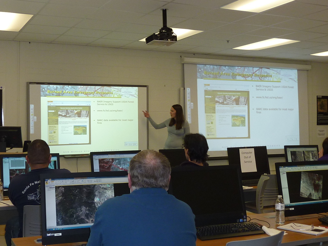
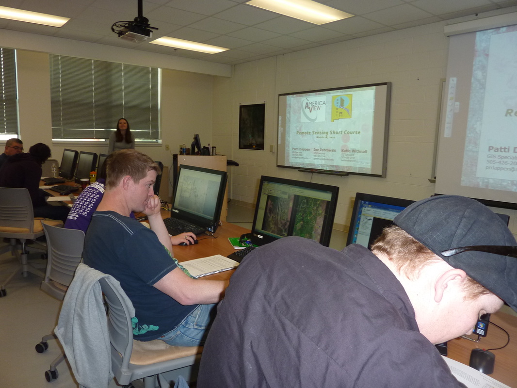
GAINS serves as a geospatial technology hub for northeast New Mexico communities. GAINS partnered with NMFWRI to provide the campus and greater Las Vegas community two remote sensing short-courses through the NASA-funded AmericaView program.
Awareness of GAINS capabilities has resulted in demand for geospatial education and training outreach to local government and non-profit entities, including the National Park Service, U. S. Fish and Wildlife Service, New Mexico Office of the State Engineer. The GAINS lab continues to assisting local organizations with the establishment and integration of geospatial technology into their activities.
Geospatial Outreach to the Community
GAINS lab has become an accessible source of GIS expertise serving many local government and non-profit entities.
The local Soil and Water Conservation District and State Forestry offices have utilized the labs services to provide restoration treatment maps and maintain treatment project databases.
The lab has also partnered with three local National Wildlife Refuges to develop and maintain geographic information datasets and create management maps for these properties.
San Miguel County and the City of Las Vegas have sought the GAINS lab’s expertise to assist with disaster planning and with integration of GIS into city utility operations.
Cost Reimbursable Projects
Some projects have extended beyond the scope of the free services the GAINS lab can provide. This has led to contract work that has expanded the lab’s capabilities, allowed for the hiring of staff, and provided educational and paid internship opportunities for students. Cost reimbursable projects must support the educational needs of students and further develop staff geospatial expertise.
Contracted to provide geospatial and data management services to:
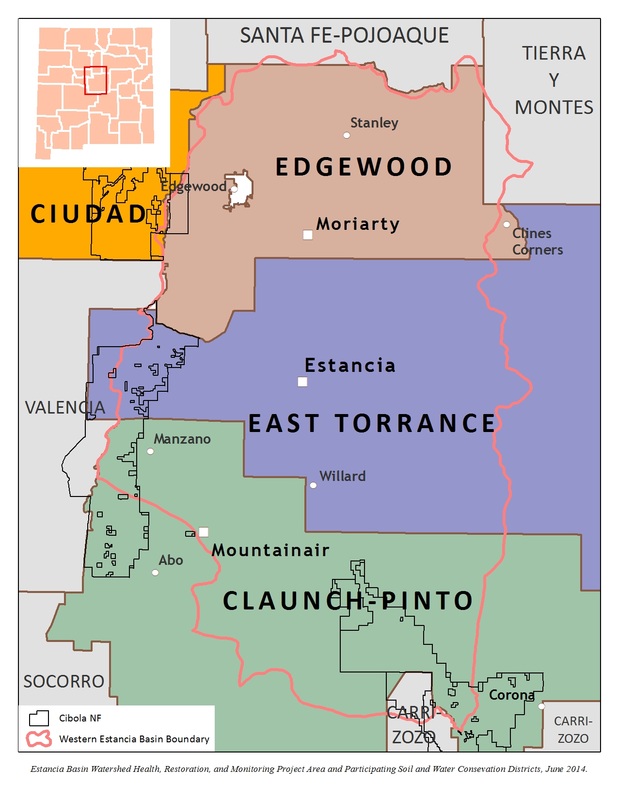
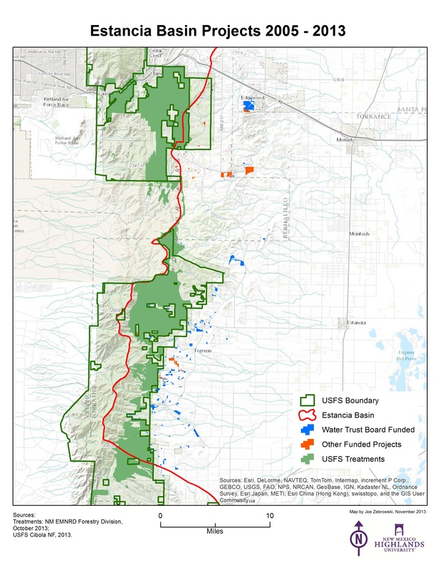
The Estancia Basin Watershed Health, Restoration, and Monitoring Project, a collaboration of Soil and Water Conservation Districts, state agencies, federal agencies, non-profits, and landowners seeking to reduce the risk of catastrophic wildfire in New Mexico’s western Estancia Basin. Participation in this effort has led to research opportunities related to fire ecology and community wildfire protection planning.
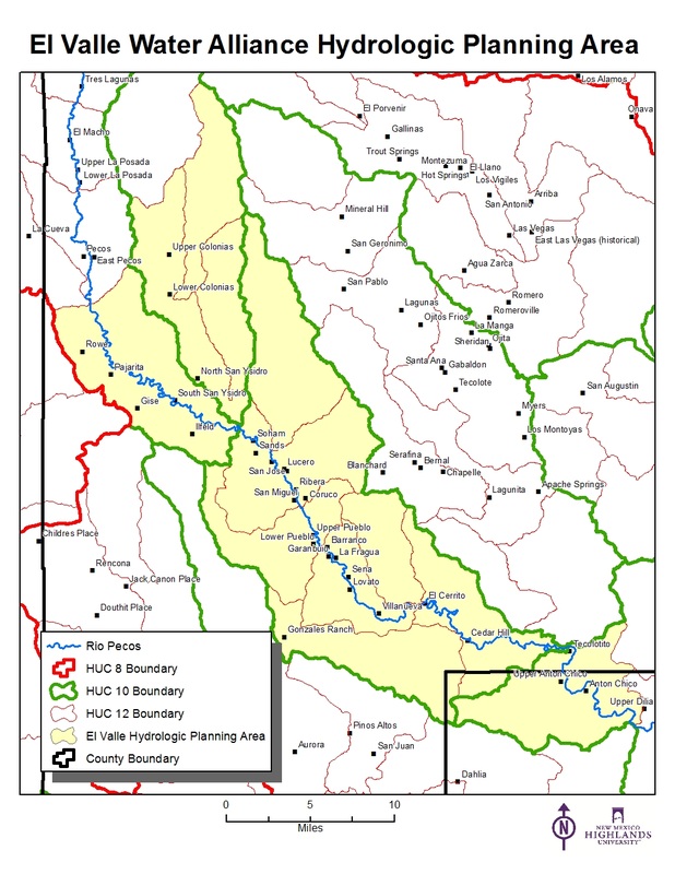
The El Valle Water Alliance, a collaborative of small, rural water utilities in the upper Pecos River watershed has contracted the GAINS lab to map the drinking water infrastructure in support of emerging asset management requirements. The Rural Community Assistance Corporation, a non-profit entity that helps build capacity in rural communities, is a partner in this project. Capabilities being developed through this project will lead to the GAINS lab becoming a center of excellence in rural water resources mapping and data management.
GAINS lab is the campus “one-stop” for geospatial technology and services. It manages GPS and survey equipment inventory for all academic departments and the New Mexico Forest and Watershed Restoration Institute.
The GAINS lab hosted GIS workshops during faculty development week. This resulted in broadened faculty awareness and interest in geospatial sciences, directly resulting in increased enrollment in GIS courses.
The lab also provided guest lecturers for professors desiring to promote the awareness of geospatial capabilities in their courses. Further contributed to increased enrollment in GIS courses. Also helped recruit students from social sciences and other disciplines outside the Natural Resources Management programs.
Lab personnel serve as co-Principal Investigators on various grant funded research projects, including the National Science Foundation funded study of the “Timing of Intercontinental Deformation across the Eastern Mono Basin, California and Nevada.”
Lab director participates in the NSF funded Integrated Geospatial Education and Technology Training (iGETT) project, which seeks to enhance the remote sensing education programs at community colleges and small universities.
Community Educational Outreach
GAINS serves as a geospatial technology hub for northeast New Mexico communities. GAINS partnered with NMFWRI to provide the campus and greater Las Vegas community two remote sensing short-courses through the NASA-funded AmericaView program.
Awareness of GAINS capabilities has resulted in demand for geospatial education and training outreach to local government and non-profit entities, including the National Park Service, U. S. Fish and Wildlife Service, New Mexico Office of the State Engineer. The GAINS lab continues to assisting local organizations with the establishment and integration of geospatial technology into their activities.
Geospatial Outreach to the Community
GAINS lab has become an accessible source of GIS expertise serving many local government and non-profit entities.
The local Soil and Water Conservation District and State Forestry offices have utilized the labs services to provide restoration treatment maps and maintain treatment project databases.
The lab has also partnered with three local National Wildlife Refuges to develop and maintain geographic information datasets and create management maps for these properties.
San Miguel County and the City of Las Vegas have sought the GAINS lab’s expertise to assist with disaster planning and with integration of GIS into city utility operations.
Cost Reimbursable Projects
Some projects have extended beyond the scope of the free services the GAINS lab can provide. This has led to contract work that has expanded the lab’s capabilities, allowed for the hiring of staff, and provided educational and paid internship opportunities for students. Cost reimbursable projects must support the educational needs of students and further develop staff geospatial expertise.
Contracted to provide geospatial and data management services to:
The Estancia Basin Watershed Health, Restoration, and Monitoring Project, a collaboration of Soil and Water Conservation Districts, state agencies, federal agencies, non-profits, and landowners seeking to reduce the risk of catastrophic wildfire in New Mexico’s western Estancia Basin. Participation in this effort has led to research opportunities related to fire ecology and community wildfire protection planning.
The El Valle Water Alliance, a collaborative of small, rural water utilities in the upper Pecos River watershed has contracted the GAINS lab to map the drinking water infrastructure in support of emerging asset management requirements. The Rural Community Assistance Corporation, a non-profit entity that helps build capacity in rural communities, is a partner in this project. Capabilities being developed through this project will lead to the GAINS lab becoming a center of excellence in rural water resources mapping and data management.